|
Seismic input Modeling for Zoning and Microzoning 2.2. FIRST ORDER ZONING OF ETHIOPIA Gouin (1976) produced the first seismic hazard map of Ethiopia using a probabilistic approach. Since the production of that map, quite a large number of destructive earthquakes occurred in the country causing damages both to property and human life. Further destructive earthquakes that occurred in the neighboring countries are not included in the production of the first map. Following the procedure described in section 2.1, Kebede and Vaccari (1996), produced a new seismic hazard map of Ethiopia and its northern neighboring countries.
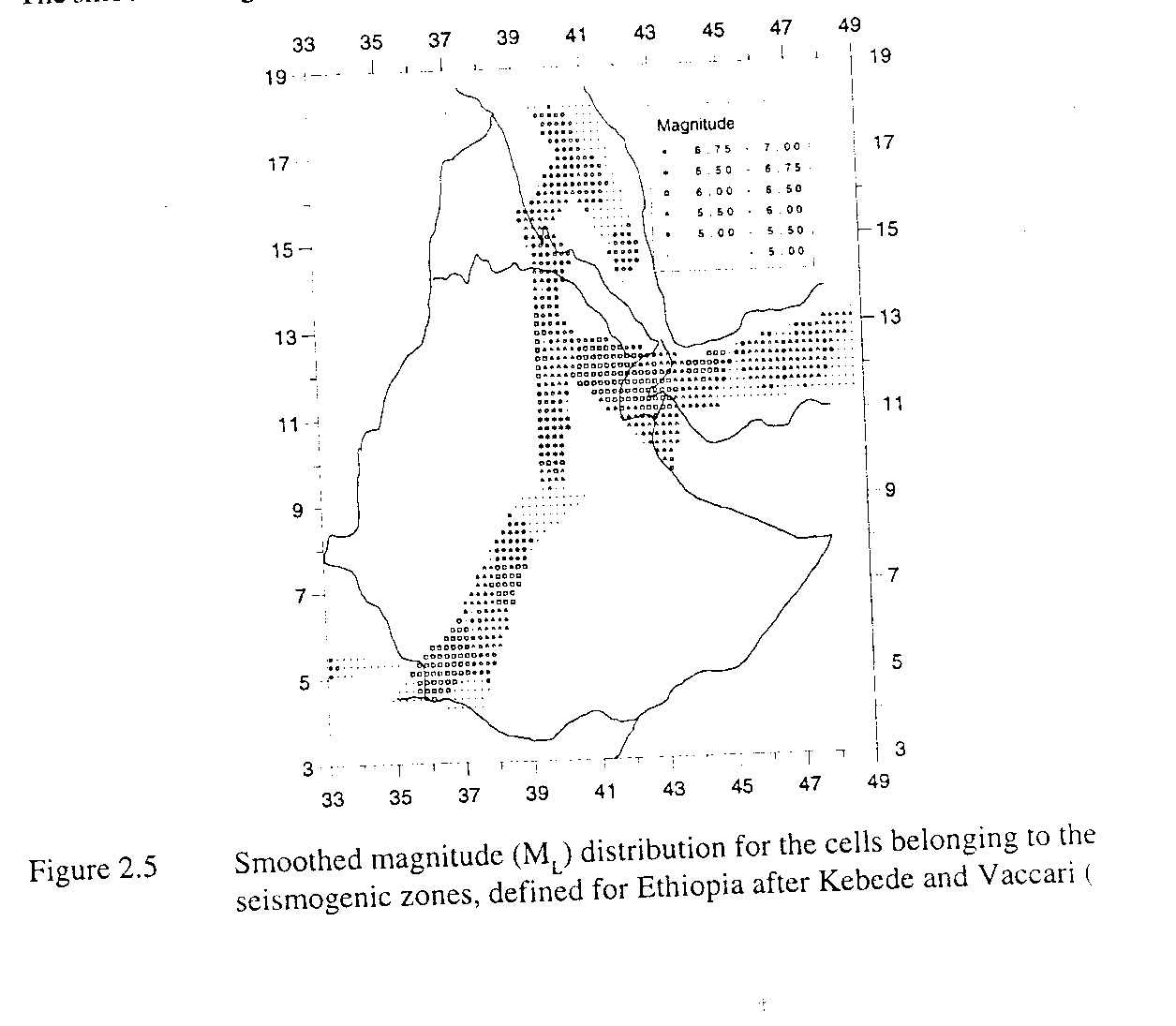
The smoothed magnitude distribution for the seismogenic zones is given in Figure 2.5
focal mechanisms and other related source parameters for the representative earthquake occurred in the seven seismogenic zones and the three main lithospheric structures (Nile rift and two for the eastern and western plateau) used in this study, are based on the existing literature. The different magnitudes present in the earthquake catalogue have been converted to ML, therefore, the magnitude-moment relation proposed by Boore (1987) has been used instead of the relation by Kanamori (1977).
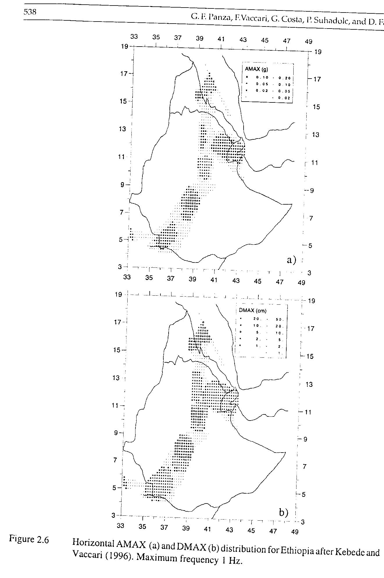
Figure 2.6a shows the zoning map obtained for the region under study from the calculated AMAX, as a fraction of g (acceleration due to gravity). A glance at the figure shows that the values of AMAX (0.1 - 0.2g) l are obtained for the main Ethiopian Rift around latitude 8 degree N and Eritrea around latitude 150N, and are compatible with the values estimated by Gouin (1976) using a probabilistic approach. The corresponding displacements DMAX can be found in Figure 2.6.
Given that the main Ethiopian rift is a region where various economic development activities are currently undertaken, and knowing that in this region the seismic hazard is high, the necessary precautions should he taken both in the development of the new built environment and the reinforcement of the existing one.
The seismic region of central and eastern Afar belongs to a different scenario. This is characterized by the occurrence of intermediate-size earthquakes with ML ties never exceeding?? Even though the seismic activity rate is high (about 4 earthquakes per year with Mb >>? relatively low (as compared to that of the main Ethiopian rift) AMAX value is obtained in the region. The probabilistic approach used by Gouiti (1976) leads to more conservative result than the deterministic one. |